


Exploring the Mykolaiv Health Route: Output 1 – Site Analysis and Surveys
UNECE has published the “Mykolaiv Health Route Pilot Project Output 1 – Site Analysis and Surveys”, now available to explore on the UN4UkrainianCities Initiative website. The report examines the site’s current conditions and the groundwork for designing the future Health Route.
For a long time, Mykolaiv’s identity and development have been closely connected to its rivers and waterfront, which have played an important role in the city’s industrial, economic and social life: currently, the city's development goals include developing this area and making it a more vibrant part of the city.
The site analysis and surveys contained in the new “Mykolaiv Health Route Pilot Project - Output 1: Site Analysis and Surveys” identified the site’s challenges and opportunities, establishing the priorities that would shape the Health Route's detailed design.
A successful vision for the future starts with understanding its existing characteristics and current identity. This is why, for the Mykolaiv Health Route Pilot Project, the design process started by investigating the site, its current conditions, and how it is used by residents and visitors.
Background
The 2024 Concept Masterplan for the City of Mykolaiv presents a vision for transforming Mykolaiv from a traditional industrial centre into a “City on the Wave”—a modern, sustainable and diversified city that reconnects with and benefits from its rivers. The Masterplan was funded by BMZ, supported by GIZ, implemented by UNECE, and prepared by an international team led by One Works Foundation in close partnership with the Mykolaiv City Council.
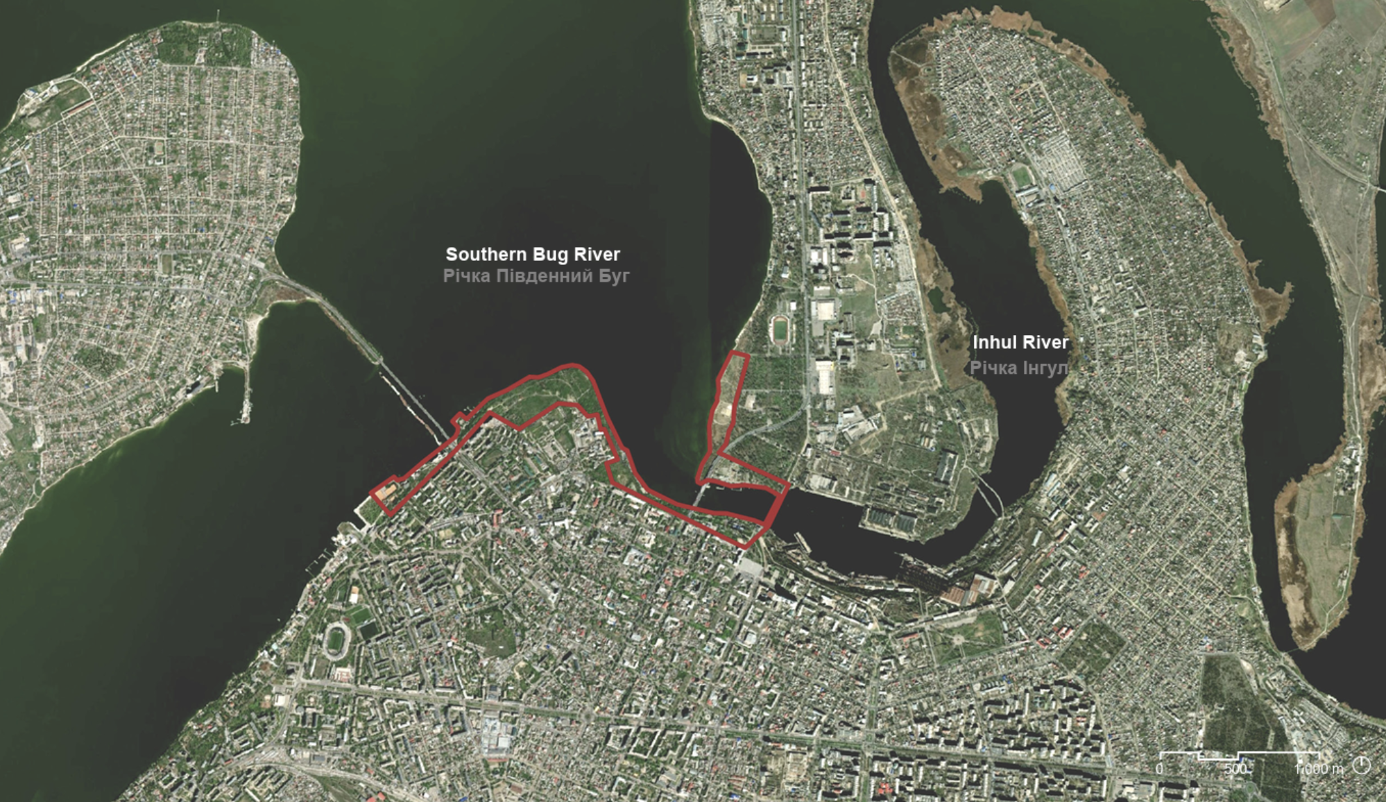
Among the Masterplan’s pilot projects, the Municipality selected the Health Route as a priority due to its potential to unlock the recreational and public-space opportunities of Mykolaiv’s riverfront. More specifically, the Health Route aims to transform a 5-kilometer waterfront stretch into a resilient ecological corridor to mitigate urban heat island effects, increase public access to green space, connecting the community, the river, and the environment.
Taking the Present into the Future
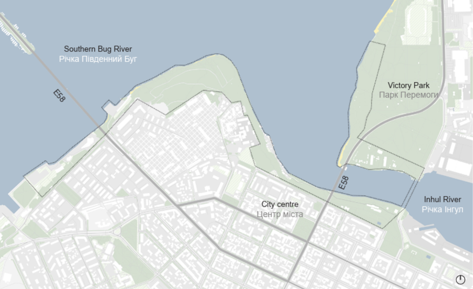
The Health Route is strategically located near cultural landmarks, green spaces, and protected natural areas. Indeed, the Health Route site is located along the Southern Bug and Inhul Rivers, extending across the district of Tsentral'nyi, the active and mixed-use city centre, and Zadovs'kyi, characterized by residential and industrial uses and the central railway station.
The site represents a key link within Mykolaiv’s wider green and blue network, with the Southern Bug River at the heart of its landscape. The river is central to Mykolaiv’s identity and a key ecological, social, and economic asset, underscoring the need to strengthen the city’s wider green network to support biodiversity, mitigate climate change, and create opportunities for social interaction. Moreover, its location, at the intersection of the city’s two vehicular bridges, provides important connections within the urban network and links Mykolaiv to nearby urban centers through roads of regional significance.
Based on these characteristics, the Health Route Pilot Project aims to:
Make the river the center of Mykolaiv’s green and social network;
Create continuous slow-mobility paths and urban connections that strengthen both visual and physical access to the Southern Bug River;
Foster biodiversity and strengthen the ecological network by safeguarding existing natural areas and Nature Reserve Fund sites;
Bring people closer to nature by increasing access to green space and creating opportunities for sports, recreation, and community activities; and
Enhance climate change mitigation, embedded in the strategy through measures such as Sustainable Urban Drainage Systems (SuDS), permeable surfaces, rain gardens, humid zones, and tree-lined boulevards.
Ultimately, the Health Route applies this broader vision into a specific site, by integrating the multidisciplinary work of an international team of experts, led by One Works Foundation and composed of the landscape architects at LAND Italia, Systematica's mobility engineers, Smart City experts from Carlo Cattaneo University (LIUC), and the Mykolaiv Water Hub.
Findings from the Site Analysis
A series of technical and spatial analyses provided a clearer understanding of the Health Route’s existing conditions, challenges and development potential:
Environmental and ecologic conditions: the Health Route has the potential to act as a unifying element within the fragmented network of local green spaces, connecting them into a coherent and continuous ecological system.
Land use: the Health Route’s land use is characterized by a residential urban fabric, industrial areas, and green spaces connected to the river system.
Morphology: the terrain presents gradual and steep slopes and returns to river level after crossing the Inhul River, a morphology that is closely related to flood risk.
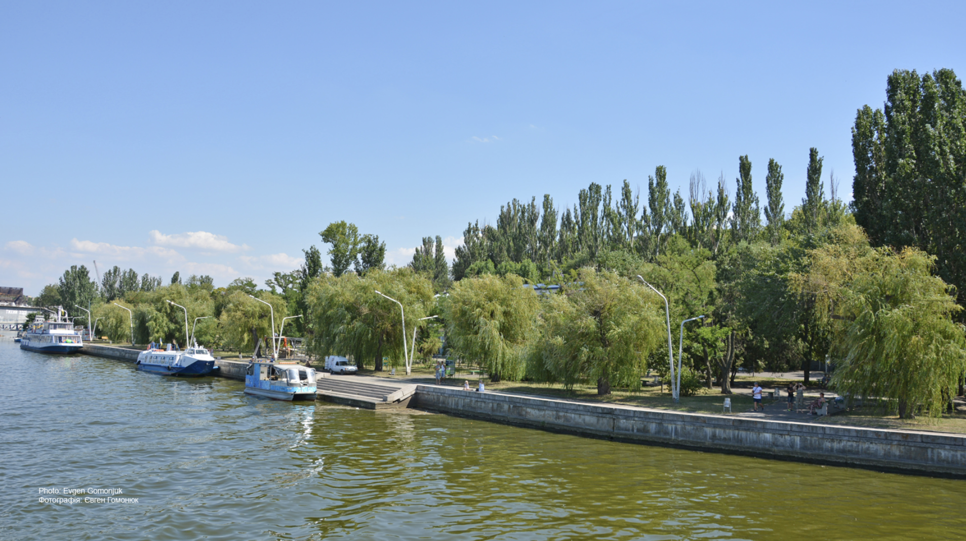
Interaction with water: the site presents several points of interaction with water and panoramic viewpoints that allow visual contact and physical access points, such as beaches or accessible edges.
Points of interest: the site hosts a number of points of interest, including nearby institutions, such as universities, stadiums, and places of cultural relevance, which strengthen the site’s role as a connector within the urban system.
Landscape: despite the Health Route’s considerable potential, its assets are currently not fully integrated within a coherent system, with underutilized and fragmented green areas and limited accessibility due to the lack of dedicated pedestrian and cycling paths.
Mobility: while the multiple mobility systems, including a number of nearby transport stops and links, intersecting the Health Route site offer strong opportunities for connectivity, the area faces significant challenges, such as heavy traffic, restricted land use due to military zones, and the current lack of accessibility to the existing pedestrian bridge.
The findings enable the experts working on the Pilot to identify and address key constraints, while building on existing opportunities to unlock the full potential of the Health Route.
Participatory Design
Community engagement was integrated from the earliest stages of the project, with support from the Mykolaiv Water Hub. It complemented the technical site analysis with the perspectives of people who live and work in the area. This approach helps ensure that the design reflects the local community’s needs, priorities and vision—as the site’s future users and experts in their own lived experience.
The online Survey: How do locals experience the Waterfront in everyday life?
Through an online survey launched in March 2026, 467 residents across all age groups shared how they use, experience and envision the future of the waterfront. Their feedback helped identify the aspects that should receive particular attention in the design of the Health Route, allowing local people to directly shape the future of this important public space. The survey revealed several key and recurring themes:
Environmental concerns, such as pollution, waste management, and litter.
Site conditions, such as poor lighting and accessibility, visibility, isolation, limited connectivity, and neglected green spaces.
Waterfront and development potential, with more than 80% believing the area could become attractive for living once the project is implemented.
Use of green and blue spaces, currently mainly utilized for relaxation, health, and well-being, followed by social interaction, with the connection to the river being the most appreciated feature of the site.
Sports and recreation, with more than 60% of respondents using the Health Route site for sports activities, such as walking, cycling, and jogging, welcoming the potential of future cultural performances.
Facilities, such as resting areas equipped with toilets, seating, and shaded areas.
Mobility, with access currently dominated by walking and public transport, with 90% of respondents willing to use the site for walking and cycling and almost 95% willing to change their transport mode once the project is implemented.
The Students’ Workshop: What Can Younger Generations Contribute to the Health Route?
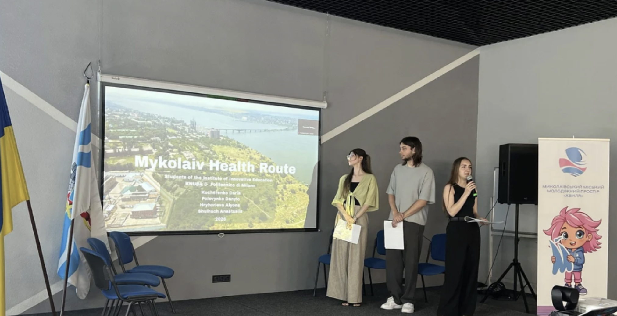
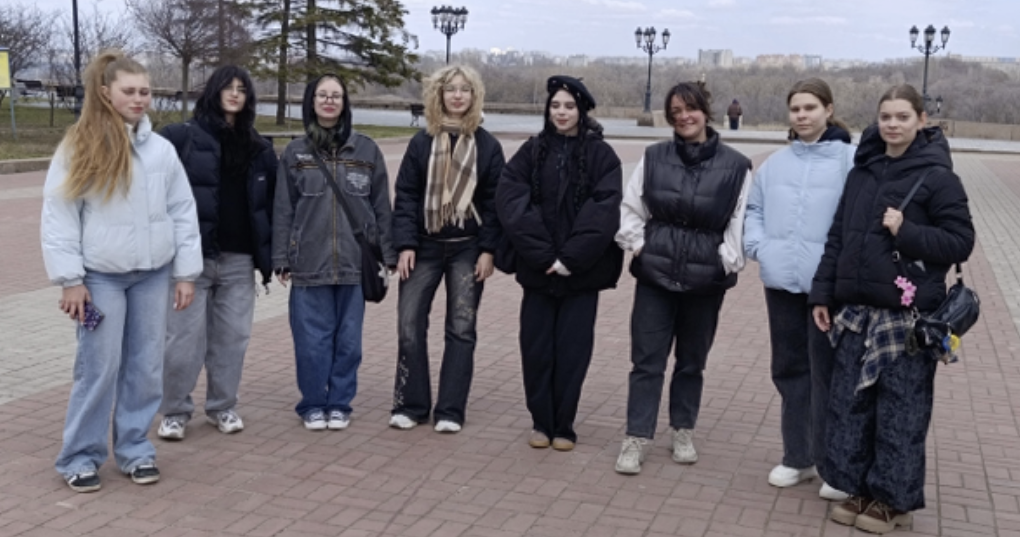
Local high-school and college students took part in a two-day workshop, supported by expert coordinators, to explore the site and contribute their ideas for its future development. Building on their site analysis, they identified key challenges and opportunities and proposed design solutions reflecting the needs and aspirations of younger generations. Their input helped refine selected elements of the project design, ensuring that the Health Route can become an inclusive, attractive and meaningful public space for young people and the wider community.
The workshop participants identified the following key challenges and proposed the design responses:
Poor accessibility, especially for persons with disabilities→ Structuring spaces to improve connectivity, including through pedestrian and cycling access, and providing overall more inclusive routes and facilities.
Underutilized areas with strong landscape and social potential → Upgrading recreational and sports facilities, with additional seating, picnic areas, and spaces for social activities, and creating multifunctional gathering spaces to foster outdoor activities and event organization.
Weak vegetation, unstable slopes, erosion and landslide risks → New planting and preservation of existing vegetation.
Unmanaged surface water runoff → Introducing landscape interventions that improve water management, such as designing new plantings providing slope reinforcement while to avoid landslides;
Informal trails → Creating designated pedestrian routes that respect the natural topography and reduce further damage to the landscape.
Insufficient cycling infrastructure → Developing continuous pedestrian and cycling routes, including key locations and the waterfront.
Limited interaction with the river → Introducing viewpoints, viewing decks, waterfront paths, a pier platform, and spaces for relaxation and interaction with the river.
Lack of dedicated spaces for different user groups → Introducing a dog-walking area, outdoor sports facilities, wellness spaces, playgrounds, and flexible recreational areas.
Need for year-round and flexible use → Combining spaces and activities that can support different seasonal uses.
Need for smart and sustainable solutions → Introducing digital maps, QR codes, smart lighting, solar panels, and energy-efficient facilities.
International Benchmarks
International landscape benchmarks were selected for their alignment with the Health Route pilot project site conditions to demonstrate how linear waterfront parks can serve as ecological corridors, climate adaptation devices, and socially active public spaces.
Mobility benchmarks were included, ensuring comparability and relevance, showcasing examples that combine accessible urban spaces with natural or semi-natural areas and integrate multimodal mobility networks.
Smart city benchmarks were identified to demonstrate how digital and innovative solutions can be integrated into urban and waterfront environments to support sustainability, resilience, and user-oriented spaces.
From Analysis to Design
Output 1 provides the essential foundation for the Health Route’s design development. By combining technical analysis with the perspectives of local residents, it brings together professional expertise and local knowledge to identify priorities, challenges and opportunities for the site.
The report explains how the project team is moving from analysis to the next stage, which is design development by translating the Health Route’s vision into a concrete, place-based design solution. It includes:
Detailed methodologies: A clear overview of how the research, spatial assessments and community-engagement activities were conducted.
Survey data: Results of the online survey, including percentages, demographic insights and supporting graphs.
Site photos and maps: Detailed visual documentation of existing site conditions and characteristics that will inform the upcoming design phase.
Output 1 is a key resource for understanding the process that informs the Health Route’s design development.